- Startseite >
- Messwerte >
- Grundwasser >
- Karte: Regnitz >
- Großhabersdorf Q 12 >
- Diagramm Messwerte
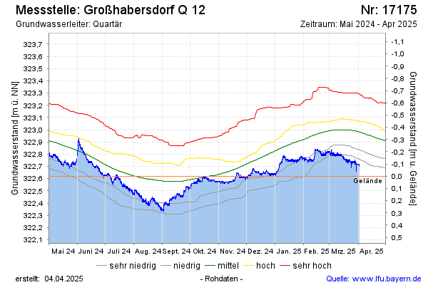
Station Großhabersdorf Q 12
Hinweis: Datendownload siehe Internetangebot Gewässerkundlicher Dienst.
| Datum Zeit | Grundwasserstand [m ü. NN] | Grundwasserstand [m u. Gelände] |
|---|---|---|
| 21.05.2026 11:00 | 322,59 | 0,03 |
| 21.05.2026 10:00 | 322,60 | 0,02 |
| 21.05.2026 09:00 | 322,60 | 0,02 |
Letzte Datenaktualisierung: Freitag 22. Mai 2026, 02:08 Uhr
© Bayerisches Landesamt für Umwelt 2026