- Startseite >
- Messwerte >
- Grundwasser >
- Karte: Inn >
- LOHHOF 275A >
- Diagramm Messwerte
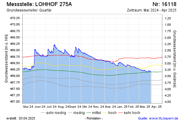
Station LOHHOF 275A
Hinweis
Die Messstelle wird aufgrund geringer Grundwasserergiebigkeit in den nächsten Wochen aufgelassen. Wir bitten um Ihr Verständnis.
Hinweis: Datendownload siehe Internetangebot Gewässerkundlicher Dienst.
| Datum Zeit | Grundwasserstand [m ü. NN] | Grundwasserstand [m u. Gelände] |
|---|---|---|
| 07.03.2026 09:00 | 467,87 | 3,62 |
| 07.03.2026 08:00 | 467,87 | 3,62 |
| 07.03.2026 07:00 | 467,87 | 3,62 |
Letzte Datenaktualisierung: Samstag 07. März 2026, 16:56 Uhr
© Bayerisches Landesamt für Umwelt 2026