- Startseite >
- Messwerte >
- Grundwasser >
- Karte: Inn >
- ECHING 275D >
- Diagramm Messwerte
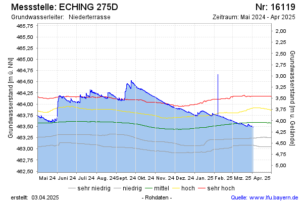
Station ECHING 275D
Hinweis: Datendownload siehe Internetangebot Gewässerkundlicher Dienst.
| Datum Zeit | Grundwasserstand [m ü. NN] | Grundwasserstand [m u. Gelände] |
|---|---|---|
| 29.06.2026 10:00 | 462,88 | 4,75 |
| 29.06.2026 09:00 | 462,88 | 4,75 |
| 29.06.2026 08:00 | 462,88 | 4,75 |
Letzte Datenaktualisierung: Montag 29. Juni 2026, 20:46 Uhr
© Bayerisches Landesamt für Umwelt 2026